Ramelius Resources
pXRF instruments now used 2x more often — with faster, more consistent classification feeding directly into 3D geological models
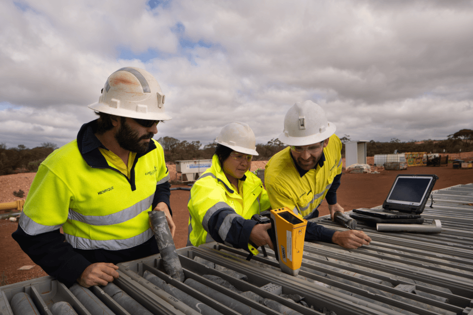
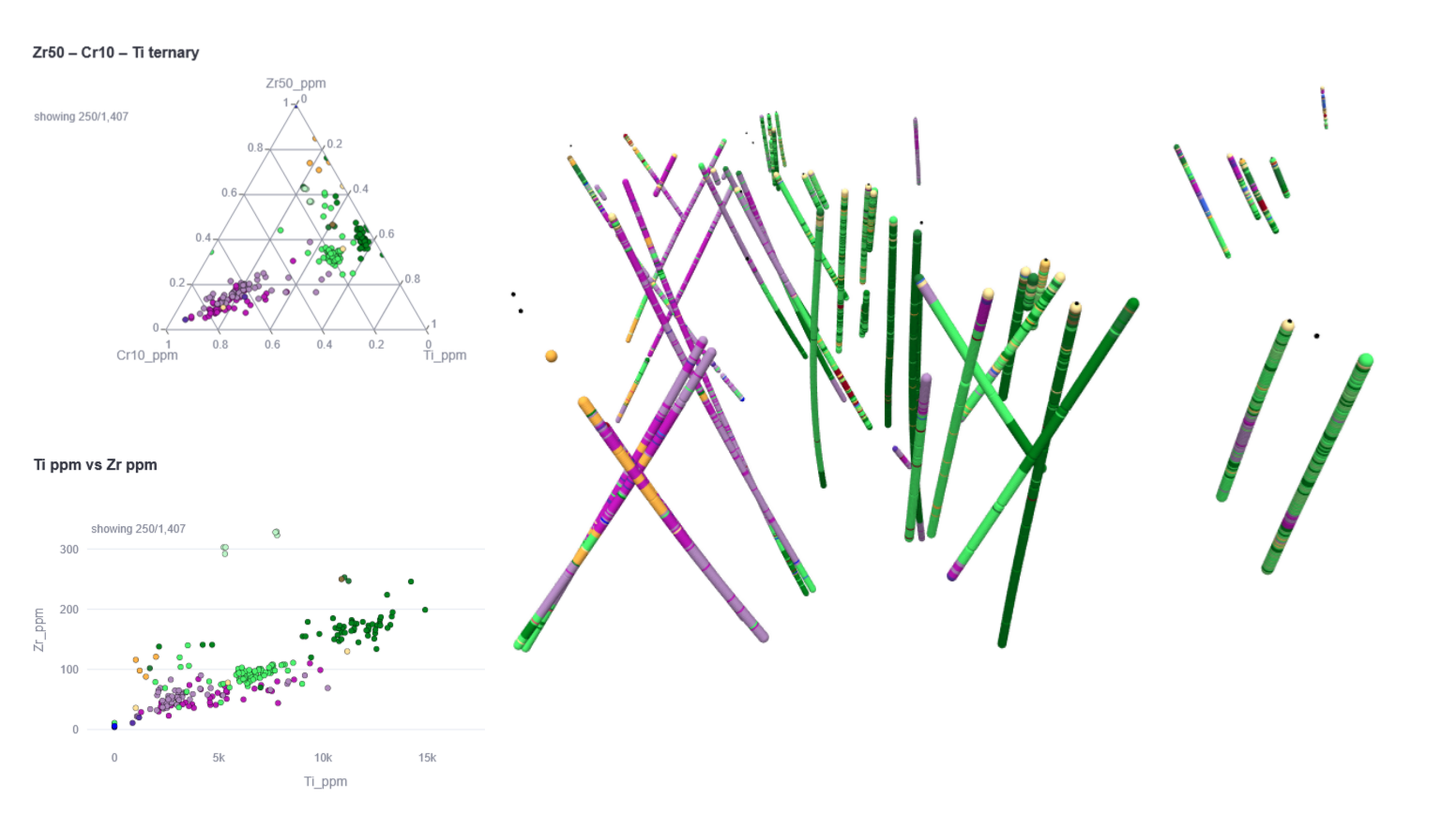
Ramelius Resources routinely uses handheld Vanta pXRF instruments on drill core and chip samples. Their team relied on manual geochemical ratios (Ti/Zr, Ni-Cr) to distinguish lithologies, with their lead geochemist running interpretations in IOGAS. Despite strong internal procedures, several pain points remained: frequent data validation errors requiring manual fixes, four pXRF instruments amplifying small human errors, and manual classification diagrams creating delays between analysis and usable results.
We implemented XRF-ZAP — a customised platform tailored to the Vanta pXRF template used by Ramelius, aligned with their database requirements. The step-by-step workflow handles CSV loading, data cleaning, validation, and database upload. Custom validation rules prompt operators to correct errors immediately. An automated QAQC dashboard monitors blank samples for contamination, tracks instrument performance via standards, and flags anomalous results for review. We then developed a custom lithogeochemical classification model using density-based clustering on the most stable immobile elements, validated with logging data, core photos, 2D/3D visualisation, and traditional geochemical discrimination methods.
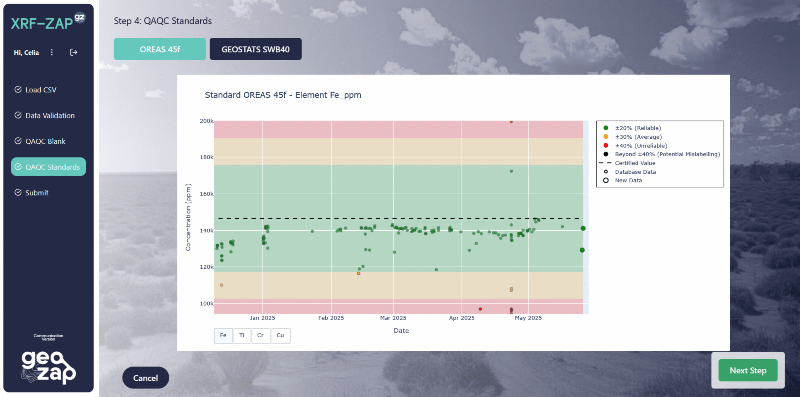
Whenever an operator uploads a new CSV through XRF-ZAP, the system automatically classifies samples using the established model. Results are appended and instantly uploaded to the Ramelius database — geologists access classified data the same day for logging and 3D modelling. Key improvements: no manual processing delays, real-time instrument monitoring with immediate QAQC flagging, doubled pXRF utilisation, and higher confidence in geological models for exploration targeting and resource domaining.