Aurenne Group Mining
Drilled by day, analysed by night. Fast, reliable classification of every metre — in Leapfrog and on the dashboard by morning.
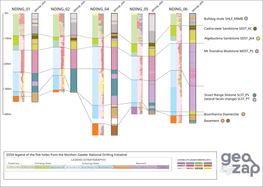
pXRF successfully reproduced the main sedimentary stratigraphy across five drillholes, with strong agreement between the geochemical classes, HyLogger mineralogy and published geological interpretation.
The Northern Gawler National Drilling Initiative, completed by the Geological Survey of South Australia and MinEx CRC, drilled through the Permian Arckaringa Basin and Cretaceous Eromanga Basin north of Coober Pedy. The project collected geological logging, HyLogger mineralogy, natural gamma, magnetic susceptibility and pXRF data across five main stratigraphic holes. Together, these datasets provide a detailed reference interpretation of the sedimentary succession. The challenge was to determine whether pXRF geochemistry alone could reproduce the main stratigraphic units, including boundaries that were difficult to recognise using visual logging or mineralogy.
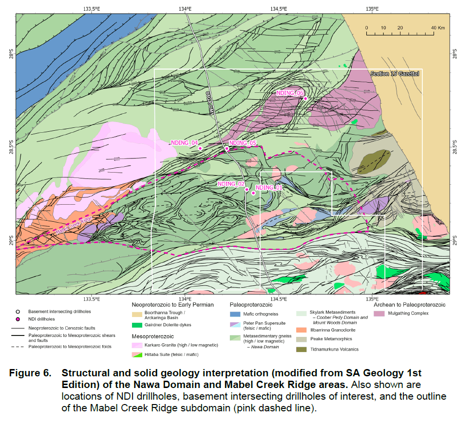
The public pXRF dataset was classified independently from the published stratigraphic interpretation. The resulting geochemical groups were then compared with the logged stratigraphy, HyLogger mineralogy, downhole petrophysical responses and the relative position of each sample within the sedimentary succession. The objective was not simply to separate sandstone, shale and siltstone. It was to test whether pXRF could recognise the specific formations of the basin and correlate them consistently between drillholes.
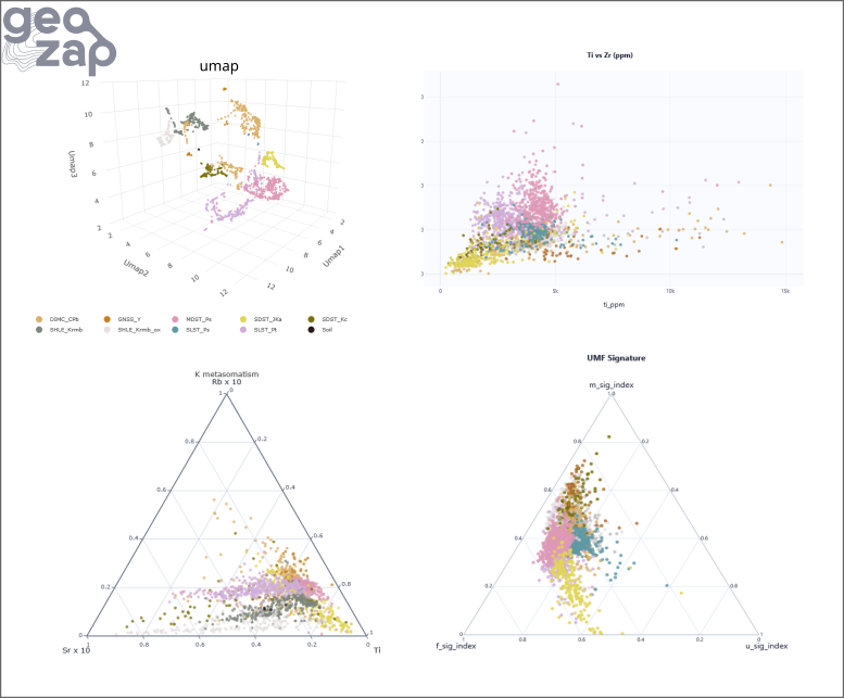
The pXRF classification reproduced most of the published stratigraphic succession across the basin. The principal sedimentary units form repeatable geochemical groups between drillholes, with a strong relationship between the pXRF classes and the mineralogical variations identified by HyLogger. The weathering and redox front within the upper Bulldog Shale is clearly recognised. The pXRF data separate the weathered upper interval from the deeper, less-weathered shale, consistent with the change from kaolin-rich material to smectite-, mica- and feldspar-bearing mineralogy. The Stuart Range Formation also shows a clear internal geochemical change. This correlates with the published mineralogical subdivision between an upper kaolin–quartz–plagioclase-rich interval and a lower white-mica–quartz-rich interval. The Cretaceous sandstone succession is the least consistent part of the published interpretation. The Algebuckina Sandstone and Cadna-owie Formation have similar lithology and quartz–kaolin mineralogy, making their boundary difficult to log confidently. However, the pXRF classification consistently identifies two geochemically distinct sandstone groups: a lower sandstone group attributed to the Algebuckina Sandstone; an upper group corresponding either to the Cadna-owie Formation or to the transition between the sandstone succession and the overlying Bulldog Shale. These groups occur in a consistent stratigraphic order across the drillholes, suggesting that pXRF can improve the separation of units that are difficult to distinguish visually or mineralogically. The crystalline basement contains relatively few pXRF analyses, so its classification is more heterogeneous and less certain than the sedimentary succession. Nevertheless, most basement samples are separated into a distinct geochemical cluster. The basal Boorthanna Formation is also naturally heterogeneous. It contains diamictite with large basement-derived clasts hosted within a finer-grained matrix. Its pXRF classification therefore varies between basement-like signatures and siltstone- or matrix-like signatures. This variability reflects the mixed composition of the formation rather than a simple classification error. Overall, this study demonstrates how five stratigraphically logged drillholes can be used to build a basin-scale lithological and stratigraphic reference model. Once validated, the model could be applied to additional drilling, allowing new pXRF analyses to be rapidly compared with the reference dataset and automatically classified within an evolving basin interpretation.